












Looking for a Slovenia map? You are in the right place.
Slovenia is a small but remarkably diverse country in Central Europe, located between the Alps and the Adriatic Sea. It borders Italy to the west, Austria to the north, Hungary to the northeast and Croatia to the south and east. Its capital, Ljubljana, lies close to the centre of the country, making it an excellent starting point for exploring Slovenia.
Use our map of Slovenia below to find the country’s most important cities, attractions, lakes, mountains, caves and coastal destinations.
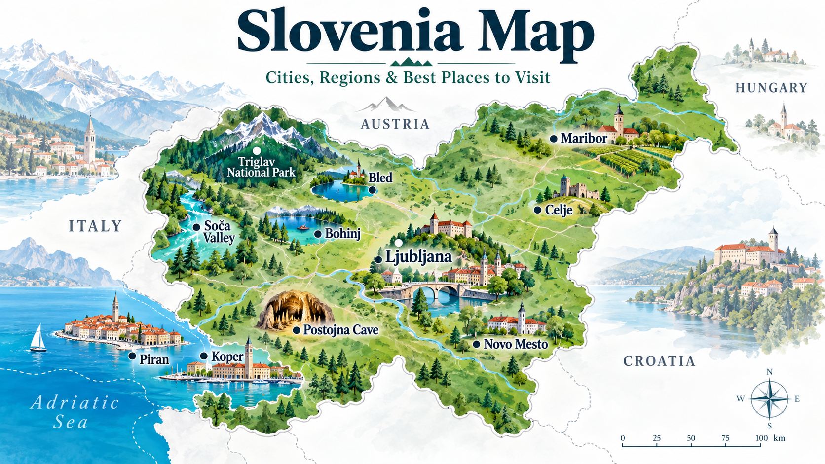
To rank for Slovenia map, I would definitely put this before almost everything else, ideally immediately after these first two paragraphs.
Where Is Slovenia on the Map of Europe?
Slovenia lies in Central Europe, at the meeting point of the Alps, the Mediterranean, the Pannonian Basin and the Dinaric region. This unusual geographical position is one of the reasons such a small country has such varied landscapes.
On a map of Europe, Slovenia can be found:
- east of Italy
- south of Austria
- west of Hungary
- north and west of Croatia
- on the northern edge of the Adriatic Sea
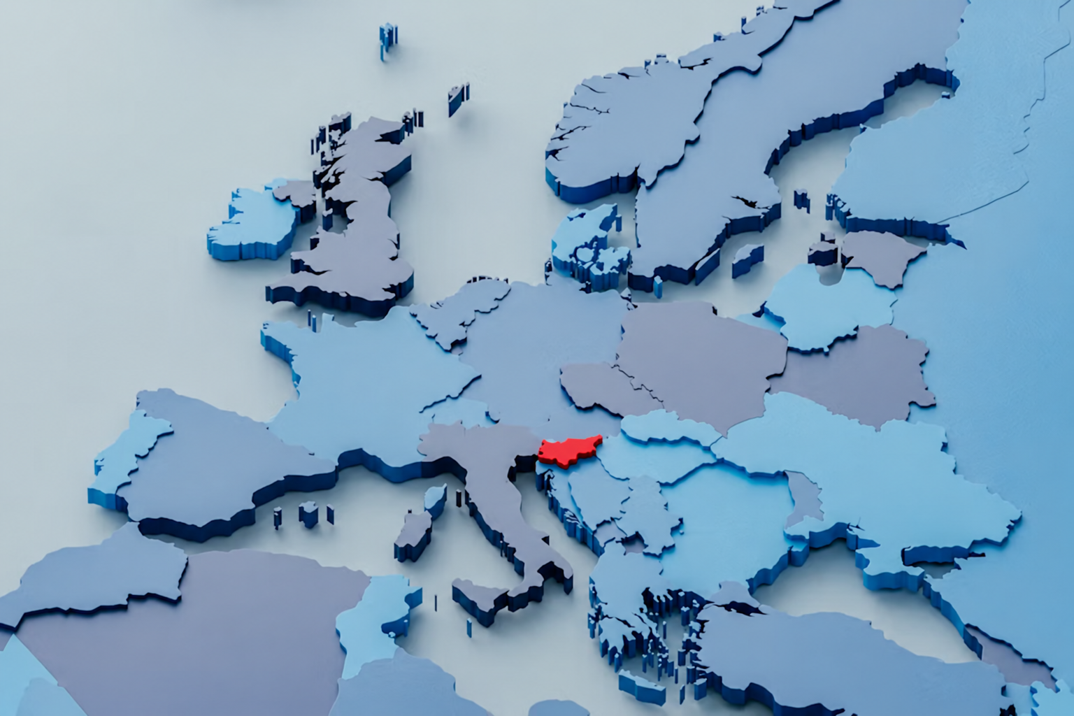
If you are looking at a Europe map and struggling to find Slovenia, look towards the top of the Adriatic Sea, between Venice, Vienna, Zagreb and the northern Croatian coast.
Slovenia on the Europe map
A locator map like this is especially important because people searching “Slovenia map” may simply want to know exactly where the country is.
Map of Slovenia
Although Slovenia covers only around 20,000 square kilometres, its geography changes dramatically over relatively short distances. Alpine mountains dominate the northwest, Mediterranean landscapes appear in the southwest, while eastern Slovenia gradually opens towards the Pannonian Plain.
The country even has a short Adriatic coastline of approximately 47 kilometres.
This means you can travel from mountains and alpine lakes to vineyards, caves, historic cities and the coast within a single trip.

Quick Slovenia Map Facts
| Country | Slovenia |
| Capital | Ljubljana |
| Region | Central Europe |
| Neighbouring countries | Italy, Austria, Hungary and Croatia |
| Sea | Adriatic Sea |
| Currency | Euro (€) |
| Highest mountain | Triglav – 2,864 m |
| Largest natural lake | Lake Bohinj |
Slovenia Map: Main Cities
When exploring a map of Slovenia, these are some of the main cities and towns you are likely to see.
Ljubljana
📍 Central Slovenia
Ljubljana is the capital and the natural starting point for many trips around Slovenia. Its compact historic centre, Ljubljana Castle, Ljubljanica River and architecture by Jože Plečnik make it one of the country’s essential stops.
Because of its central position, Ljubljana also works extremely well as a base for day trips.
INTERNAL LINK: Things to Do in Ljubljana
Maribor
📍 Northeastern Slovenia
Maribor is Slovenia’s second-largest city and the main urban centre of the country’s northeast. It is particularly known for wine, the Drava River and the world’s oldest vine.
INTERNAL LINK: Things to Do in Maribor
Koper
📍 Slovenian coast
Koper is Slovenia’s largest coastal city and an important gateway to the country’s short but beautiful Adriatic coastline.
Nearby you’ll find Piran, Portorož and Izola.
Kranj
📍 Northwestern Slovenia
Kranj lies between Ljubljana and the Alps and is one of the main urban centres of the Gorenjska region.
It is also conveniently positioned for exploring Bled, the Julian Alps and northern Slovenia.
Celje
📍 Eastern Slovenia
Celje is known for its medieval history and impressive Celje Castle overlooking the city.
Novo Mesto
📍 Southeastern Slovenia
Set on a bend of the Krka River, Novo Mesto is the main centre of the Dolenjska region and an excellent starting point for discovering southeastern Slovenia.
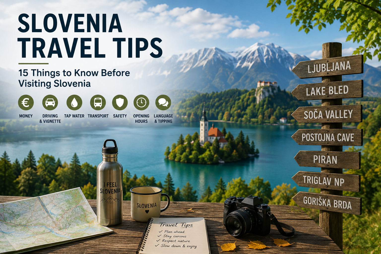
Slovenia Tourist Map: Best Places to Visit
A simple political map tells you where Slovenia is. A good Slovenia tourist map, however, should show you where to go.
These are the places we recommend marking first.
1. Ljubljana
Slovenia’s lively but relaxed capital combines historic streets, cafés, cultural attractions, markets and green spaces.
2. Lake Bled
Probably Slovenia’s most recognisable destination, Lake Bled is famous for its island, church, cliff-top castle and Alpine backdrop.
3. Lake Bohinj
West of Bled lies Lake Bohinj, Slovenia’s largest natural lake and one of the gateways to Triglav National Park.
4. Triglav National Park
Covering a large part of northwestern Slovenia, the country’s only national park includes some of Slovenia’s most spectacular Alpine scenery.
5. Soča Valley
The turquoise Soča River cuts through western Slovenia and is surrounded by mountains, hiking routes and outdoor adventures.
6. Postojna Cave
Slovenia’s karst landscape is famous for its caves. Postojna Cave is one of the country’s best-known natural attractions.
7. Predjama Castle
Built dramatically into a cliff, Predjama Castle is located close to Postojna and is easily combined with a visit to the cave.
8. Piran
One of the most beautiful historic towns on the Adriatic, Piran is known for Venetian architecture, narrow streets and sea views.
9. Maribor and Štajerska
Eastern Slovenia offers vineyards, wine roads, historic towns and a noticeably different landscape from the Alps.
10. Velika Planina
Close to Ljubljana, Velika Planina is known for its mountain plateau, traditional herdsmen’s huts and spectacular Alpine views.
Slovenia Regions Map: Four Different Worlds
One of the easiest ways to understand the map of Slovenia is through its four major tourism areas.
Alpine Slovenia
Best for: mountains, lakes, hiking and outdoor adventures
Main places include:
Bled, Bohinj, Kranjska Gora, Soča Valley and the Julian Alps.
Ljubljana & Central Slovenia
Best for: culture, city breaks, gastronomy and easy day trips
The region is centred around Ljubljana, with much of Slovenia reachable within relatively short driving distances.
Mediterranean & Karst Slovenia
Best for: sea, caves, historic coastal towns and Mediterranean food
Look for:
Piran, Portorož, Koper, Izola, Postojna and the Karst.
Thermal Pannonian Slovenia
Best for: spas, wine, castles and countryside
Eastern Slovenia is characterised by rolling hills, vineyards, thermal springs and historic towns.
How Far Is Everything in Slovenia?
One of the most useful things you notice when looking at a Slovenia map is just how compact the country is.
Ljubljana sits roughly in the middle, which means many of Slovenia’s best-known attractions work well as day trips from the capital.
You can have breakfast in Ljubljana, spend part of the day in the Alps and reach the Adriatic coast later the same day.
That compactness is one of Slovenia’s biggest advantages for travellers.
Slovenia Road Map
Travelling by car is one of the easiest ways to explore Slovenia beyond its cities.
The motorway network connects Ljubljana with:
Bled and the northwest,
Maribor and the northeast,
Koper and the Adriatic coast, and
Novo Mesto and southeastern Slovenia.
For visitors planning a road trip, we recommend using the Slovenia map not just to connect major destinations but also to discover smaller towns, wine regions and countryside between them.
HERE I WOULD ADD:
👉 Slovenia road-trip map
👉 Suggested 5-day Slovenia route
👉 Suggested 7-day Slovenia route
This gives us another opportunity to capture searches around Slovenia road trip map.
Slovenia Map for First-Time Visitors
If this is your first trip to Slovenia, a simple route on the map could look like:
Ljubljana → Bled → Bohinj → Soča Valley → Postojna → Piran → Ljubljana
This itinerary includes the capital, Alps, lakes, mountains, karst and Mediterranean coast and gives you an excellent overview of how geographically diverse Slovenia really is.
Is Slovenia Easy to Travel Around?
Yes. Slovenia’s relatively small size makes travelling between regions straightforward.
The official Slovenian tourism portal also provides an interactive map covering accommodation, attractions, activities and other points of interest throughout the country.
For travellers who want maximum flexibility, travelling by car is useful, while trains and buses connect many of the country’s larger towns and tourist destinations.
Slovenia Map FAQ
Where is Slovenia on the world map?
Slovenia is located in Central Europe, between Italy, Austria, Hungary and Croatia, with access to the Adriatic Sea.
Is Slovenia in Europe?
Yes. Slovenia is a Central European country and a member of the European Union.
What countries border Slovenia?
Slovenia shares borders with Italy, Austria, Hungary and Croatia.
What is the capital of Slovenia?
The capital of Slovenia is Ljubljana, located close to the centre of the country.
Does Slovenia have a coastline?
Yes. Slovenia has a short coastline on the Adriatic Sea, between Italy and Croatia.
Where is Lake Bled on the Slovenia map?
Lake Bled is in northwestern Slovenia, around 50 km northwest of Ljubljana.
Where are the Slovenian Alps?
The main Alpine landscapes are in northern and northwestern Slovenia, including the Julian Alps and the area around Triglav National Park.
How big is Slovenia?
Slovenia covers approximately 20,271 km².
Is Slovenia close to Italy?
Yes. Slovenia shares its entire western border with Italy. Trieste and Venice are among the best-known Italian cities relatively close to Slovenia.